Introduction
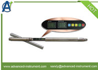
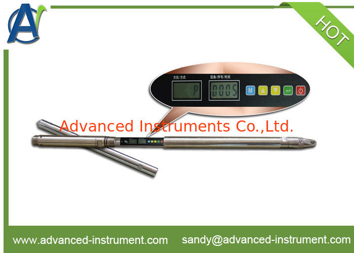
The digital compass inclinometer is designed and manufactured to meet the requirements of inclinometer and directional control for engineering drilling, exploration drilling, and directional drilling in non-magnetic areas. The inclinometer integrates multiple units such as sensors, power supply, and digital processing, and independently completes the measurement of the apex angle and azimuth angle of the borehole in a single point / multipoint manner. No cables, no mechanical moving parts, reliable performance, and high cost performance. This wireless inclinometer can be widely used in engineering, hydrology, oil field, coal field, geology and other fields to measure the apex angle and azimuth angle of drilling holes with a diameter greater than 40 mm.
I. Main technical features
1. The biggest characteristic of the instrument is to provide independent research and development of supporting software,, and computer communication can be realized after displaying three-dimensional projection and spatial trajectories and printing, Convenient user read figure ,sentenced map, or for further analysis and research.
2. Using high-precision 24-bit A / D, gravity accelerometer and three-dimensional magneto-resistive sensors, measurement data reliability and high accuracy.
3. Application of digital timing and digital storage technology, a maximum of 100 points can be measured at a time, and can save 1000 measurement data.
4. The use of seismic design, seismic capability of the instrument, the overall performance of the index much higher than conventional mechanical compass inclinometer instruments.
Reasonable price, high accuracy, no cable, the latest technology research crystallization of the oblique technology.
II. Main technical specifications
| 1 |
Inclinometer depth |
≤1500 m |
| 2 |
Measuring range and error |
Angle measuring range: 0 ~ 50 °, measurement error: ± 0.2 °;
Azimuth measuring range: 0 ~ 360 °;
When the angle 1 ~ 3 °, the measurement error: ± 5.0 °;
When the apex angle of 3 ~ 50 °, the measurement error: ± 3.0 °;
|
| 3 |
Measurement |
Point measuring |
| 4 |
The delay time measuring |
(1 to 180) minutes adjustable |
| 5 |
The measured time interval |
(1 to 60) and minutes adjustable; |
| 6 |
Measurement points |
(1 - 100); |
| 7 |
Data sets can be saved |
100 groups (measuring point total storage number 1000) |
| 8 |
Power supply |
Built-in lithium battery, a charge can work for 32 hours (new battery) |
| 9 |
Inclinometer probe dimension |
Φ40mm × 1320mm |
| 10 |
Working temperature |
0 ℃ ~ 55 ℃. |